Application scenarios
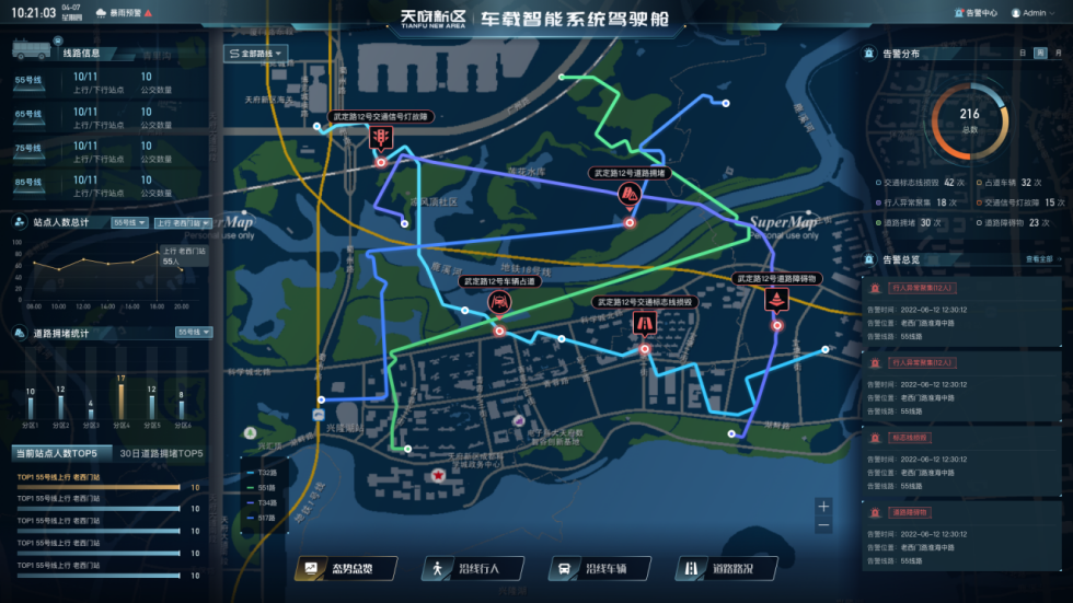
Data dashboard - cockpit
Present overall situation based on GIS map
Overall situation: overview of station passenger count, pedestrian and vehicle events, road condition events
Pedestrians along route: real-time/historical ranking of station passenger count, pedestrian gathering distribution map
Vehicles along route: traffic congestion, illegal parking event distribution map
Road conditions along route: weather anomalies, traffic light failures, road marking damage, road
Bus in-vehicle backend intelligent analysis application
Specific analysis and application of bus station passenger count, pedestrian and vehicle events, road condition events.
GIS map-based display, various data analysis statistics and abnormal events
List-based display, various data analysis statistics and abnormal events
Event trigger rules and linkage handling settings
Support viewing associated historical video
Resource management
Management and maintenance of basic information such as bus routes, bus stops (up/down direction), and bus vehicles, supporting data acquisition from third-party bus platforms
Business Modules
Face payment for metro
Based on face recognition algorithm platform, supports tens of millions of face databases, provides services such as face registration, face gate pass, and online payment deduction, with millisecond response for face gate pass.
Smart station
Based on station HD network camera video streams, combined with visual AI algorithm analysis, realize real-time monitoring and early warning of abnormal personnel behavior and abnormal equipment status in the station.
Accurate passenger flow
Relying on HD network cameras from station hall, platform to carriage, realize real-time monitoring and early warning of passenger flow routes and crowd density in station hall/platform/carriage.
Safety control
Relying on HD cameras in metro depots and metro construction sites, realize safety behavior management of construction personnel and 360° status monitoring of key vehicle components.